關於這個地點
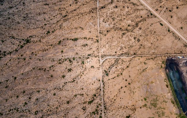
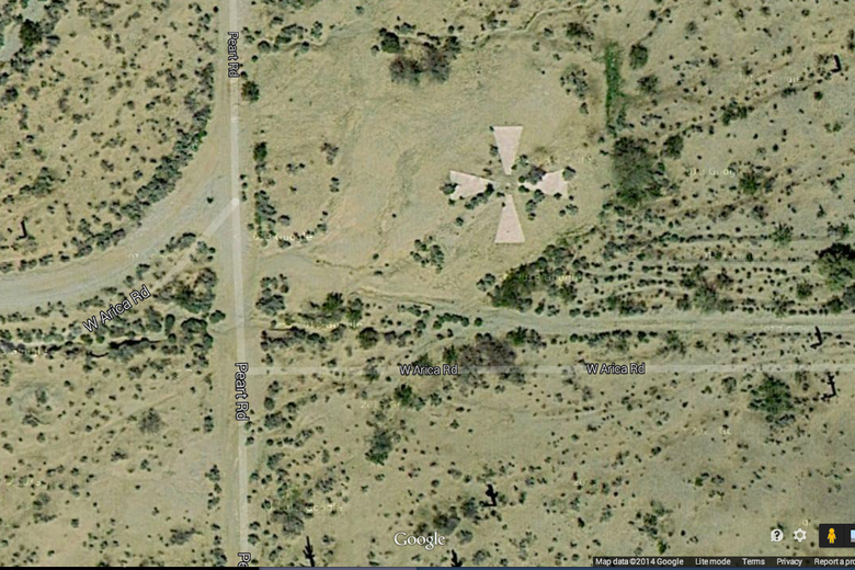
人們普遍認為,亞利桑那州卡薩格蘭德市周圍的混凝土十字架被用於 CORONA 情報衛星計畫。事實並非如此。雖然這個目標網路很有趣,但其目的不是校準 CORONA 太空船或任何相關太空船的相機。
然而,這些十字是為了校準航空攝影測量相機以驗證地圖而建造的。雖然美國空軍確實使用卡薩格蘭德靶場對某些測繪相機進行航空(飛機)相機校準,但它並未用於天基情報相機系統。
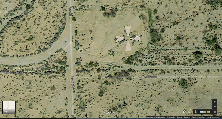
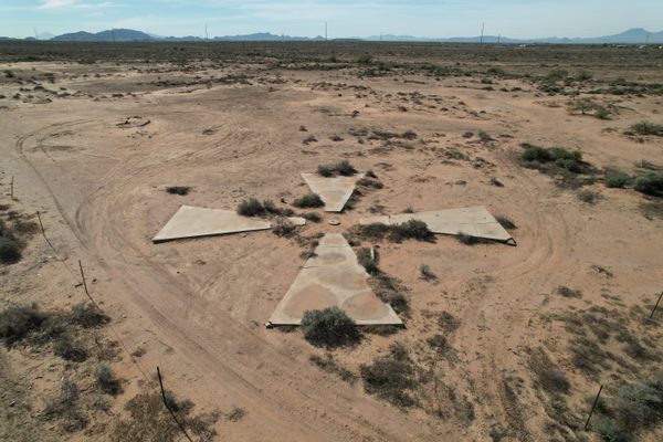
卡薩格蘭德目標是官方稱為卡薩格蘭德攝影測量測試靶場的一部分,該靶場由 16 x 16 英里的 60 英尺目標網格組成。每個目標的間隔約為 1 英里。這些目標為攝影測量計算提供了固定的空間網格,以用於繪製相機校準/驗證。
關於電暈:首先也是最重要的; CORONA 計劃是一個高度機密的計劃,因此所有技術資訊都受到很好的控制,並且永遠不會在公共環境中使用校準工具。保密控制非常嚴格,以至於大多數參與該計畫的人員直到 1995 年解密後才知道 CORONA 這個名字。
CORONA 相機的校準是在實驗室環境中進行的(而不是在飛行中的太空器上——通常被誤解)。因此,相機的精度和焦距將使卡薩格蘭德目標無法用於焦點校準。
實際上,CORONA 相機是在實驗室中根據從受控範圍網路 (CORN) 收集的資訊將膠片平面升高幾分之一毫米來進行校準的。這些高解析度網格型目標位於受控區域(軍事基地),以防止外部機構直接存取該流程。 CORN 計劃還納入了可以根據特定任務飛行概況部署的移動目標。他們 [CORN] 使用不同的灰階和特定的顏色圖案來計算可見光和紅外線曝光膠片的邊緣焦點。
延伸圖集